Campus Martius & Cadillac Square – Enhancing the Benefits Of Community Parks
Detroit & Metro Detroit, Michigan, USA
Well designed and managed parks enhance the livability of our cities while offering tremendous benefits to surrounding communities. The tangible benefits of parks include the generation of economic wealth and improved public health. While parks are designed and managed to generate community benefits, there remains a need for tools that can more rigorously measure how communities use their parks and to quantify derived benefits on varying spatiotemporal scales. The overarching goal of the proposed project is to advance a data-driven methodology to continuously assess park use and public appreciation of benefits derived


-
Principal Investigators
-
Other Contributors
Gabe Draughton
Curt Wolf, PE
Current park design methodologies embody design principles that are based on historical evidence and intuitive feel for what makes a space inviting and how curation of the space can serve community needs. However, parks are rarely studied well after commissioning to assess if design assumptions remain valid and if design features are tangibly achieving the community benefits sought. This prevents managers from deploying limited resources to update and improve their park spaces in an optimal manner.
The project aims to utilize a data-driven framework that combines a scalable monitoring strategy to sense how people use park spaces with longitudinal surveys implemented to track community perceptions of park benefits over time. This project will work focus on deployments in Campus Marcius and Cadillac Square parks in Detroit.
The project conceptually organizes park function into four interconnected layers of functional abstraction. The first layer is the physical layer and consists of the spatial dimensions of the park including how the park interacts with other spaces in the city. The second layer is the asset layer consisting of the physical objects (e.g., paths, benches, trash cans, playgrounds) that service park activities. The third layer is the social layer and consists of community members, their activities, and social interactions both within the park as well as outside of the park. The final layer is a mobility layer and represents how people move within the park space, how patrons access (e.g., enter and exit) the park, and the broader suite of mobility services (e.g., public transit) that facilitate regional access. This approach to abstracting how parks function provides a framework for identifying how data can be used to study the function of each layer and provides a basis for making decisions on how parks are managed to achieve desired community outcomes.
The project will explore the adoption of computer vision using video of public open spaces from security cameras installed in parks to automate the identification of how members of the community use their parks. This will offer real-time spatiotemporal mapping of users and their activities. Specifically, it would identify how people interact with park assets (Asset Layer), classify social behavior (Social Layer) and map people movements including user access to the park (Mobility Layer). The proposal adopts advanced machine learning tools such as deep learning of image detectors to automate the process of identifying people and their activities. The continuous nature of the approach provides park managers with a deeper understanding of how their decisions will impact members of the community and a means of assessing in near real-time if their decisions have had desired outcomes.
Quantitative data on park users derived from camera images empower stakeholders to understand how park amenities are being used and allow them to map how resource investments are leading to desired park outcomes (e.g., facilitating physical and recreational activity, encouraging social interactions, improving user access to spaces infrequently used). Especially in under-resourced communities, data-driven space curation can lead to major gains in operational efficiency making park management more cost-effective thereby allowing limited budgets to do more.


Funding Source
Downtown Detroit Partnership
Quicken Loan Fund
Related Projects

Using Technology to Keep Seniors Safe
Ypsilanti, Michigan, USA
Using wearable-based technology to help seniors stay mobile and age in place, while avoiding exposure to falls and environmental risks or hazards.
Learn More

Improving Public Transportation
Benton Harbor, Michigan, USA
Collecting travel data to help Benton Harbor improve travel options for residents, with the goal of increased employment participation and retention.
Learn More

Protecting Public Health with Improved Water Service
Benton Harbor, Michigan, USA
Improving Benton Harbor’s aging water system using risk assessment and risk analysis techniques, as well as mobile sensors.
Learn More
Transforming Shipping Containers into Chronic Care Clinics
Sandy Bay, Hanover Parish, Jamaica
The first in a series of health clinic prototypes that bring technology-enabled chronic health care monitoring to remote, underserved global populations.
Learn More
Connecting Mobility and Social Access
Chicago, Illinois, USA
Rethinking how transit infrastructure can expand access to food, health, learning, and mobility services by creating multimodal hubs.
Learn More
Enhancing Decision Making along the Detroit Riverfront using Remote Sensing and Computer Vision Tools
Detroit & Metro Detroit, Michigan, USA
Using remote sensing and security camera data to better understand how people are using the Detroit RiverFront Conservancy public spaces.
Learn More
Remote Sensing Techniques for Highway Retaining Walls
Detroit & Metro Detroit, Michigan, USA
Structural monitoring of highway retaining walls using remote sensing techniques to assess performance and prioritize infrastructure investments.
Learn More
Demonstration Project for Real-Time Stormwater Control in Southeast Michigan
Detroit & Metro Detroit, Michigan, USA
Application of real-time sensing and dynamic control on existing wastewater infrastructure to reduce the frequency and volume of Combined Sewer Overflows.
Learn More
Point of Use Water Filters: A Grassroots Train-the-Trainer Program
Flint and Flint, Michigan, USA
A grassroots train-the-trainer program on how to install, operate and maintain faucet-mounted point-of-use filters to protect for lead in drinking water.
Learn More
Sensors in a Shoebox
Detroit & Metro Detroit, Michigan, USA
The Sensors in a Shoebox project focuses on empowering Detroit youth as agents of change for their city.
Learn More

Energy Savings through Integrated Personalized, Real-time Traveler Information and Incentive Scheme
Washington DC-Baltimore, Metropolitan Downtown Area, USA
The project aims to reduce energy use of vehicular travels by incentivizing individual travelers to adjust travel choices and driving behaviors.
Learn More
Bendable Concrete Utilized on a Bridge Deck (Engineered Cementitious Composite or ECC)
Ypsilanti, Michigan, USA
A major source of bridge deterioration requiring constant maintenance is mechanical expansion joints installed between adjacent simple span bridge decks.
Learn More
Mapping Detroit’s Digital Divide
Detroit & Metro Detroit, Michigan, USA
Mapping detailed geographies of digital access and exclusion across Detroit’s neighborhoods.
Learn More
In-Place Structural Monitoring of Cast Iron Water Main Renewal
Detroit & Metro Detroit, Michigan, USA
The Great Lakes Water Authority is looking for ways to rehabilitate large diameter water mains without actually having to dig up city streets.
Learn More
Treating PFAS Impacted Groundwater using Plasma
Ypsilanti, Michigan, USA
A PFAS treatment approach for groundwater using low-temperature plasma with a concentration phase
Learn More
Assessment of Risk for Southeast Michigan’s Drinking Water Transmission System
Detroit & Metro Detroit, Michigan, USA
The University of Michigan is developing a structural reliability framework to quantify the probability of failure of pipe segments throughout the GLWA system.
Learn More

Data-Driven Decision-Making Framework for Risk Management of the GLWA Water Transmission System
Detroit & Metro Detroit, Michigan, USA
The goal of this project is to develop a data-driven asset management framework that quantifies risk in the water distribution network for southeast Michigan.
Learn More
Ox Creek Corridor Visioning Project
Benton Harbor, Michigan, USA
The city of Benton Harbor wishes to transform Ox Creek into a residential, recreational and commercial centerpiece linking important segments of the community.
Learn More
Partnering Workers with Interactive Robot Assistants to Usher Transformation in Future Construction Work
Ann Arbor and Detroit & Metro Detroit, Michigan, USA
Robots are anticipated to make the global construction industry safer and more attractive to workers, easing a worker shortage in the United States.
Learn More
State of Michigan Water Infrastructure Regional Planning
The State of Michigan, Michigan, USA
Recommendations were developed to promote regional planning to ensure infrastructure investments are equitable and result in high-quality drinking water.
Learn More
Great Lakes Legacy Act (GLLA) Restoration of the Rouge River
Detroit & Metro Detroit, Michigan, USA
The Urban Collaboratory is working with the USEPA and the Great Lakes Water Authority to remediate and restore the Rouge River.
Learn More
Enabling Independent Mobility in People with Physical Disabilities by Advancing Human-Centered Social and Technological Research
Ann Arbor and Ypsilanti, Michigan, USA
The goal of this project is to explore seamless and independent mobility for people with physical disabilities.
Learn More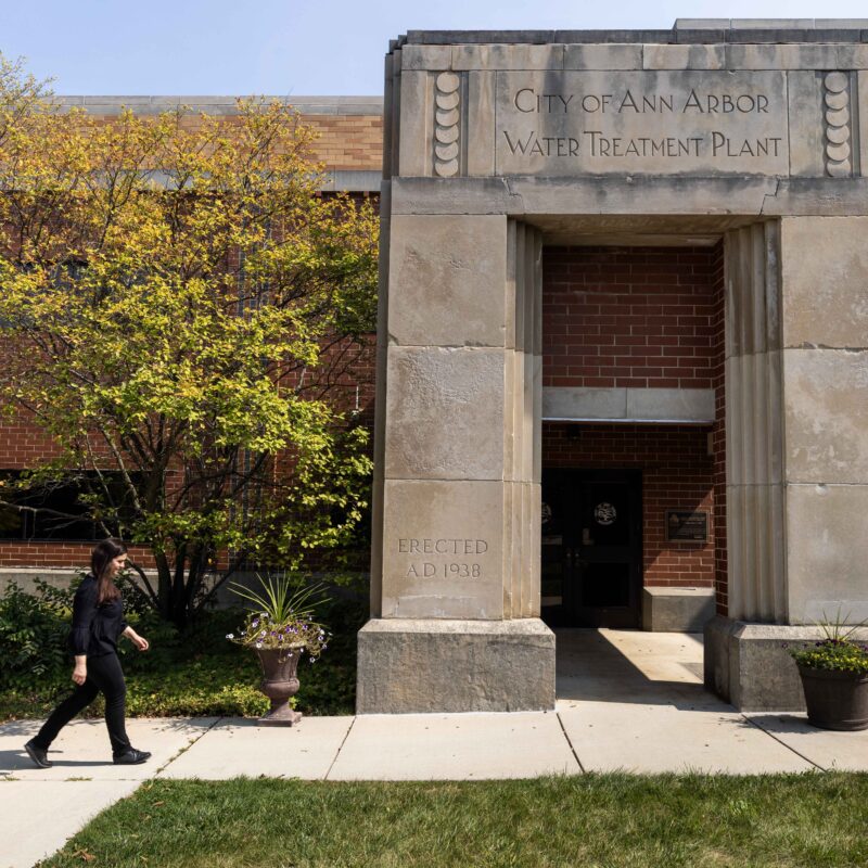
Leveraging the City of Ann Arbor’s Water Treatment Pilot Plant to Inform Treatment of Emerging Contaminants Across the State of Michigan
Ann Arbor, Michigan, USA
The University of Michigan (UM) conducted a comprehensive research project in collaboration with the City of Ann Arbor Drinking Water Treatment Plant (AADWTP).
Learn MorePrincipal Investigators
Jerome Lynch PhD
Principal Investigator
Co-Founder
Donald Malloure Department Chair, Department of Civil and Environmental Engineering
Professor of Civil and Environmental Engineering
Professor of Electrical Engineering and Computer Science
Jerome P. Lynch, Ph.D. has been a member of the faculty at the University of Michigan since 2003. He was formerly the Donald Malloure Department Chair of Civil and Environmental Engineering. He was formerly a Professor of Civil and Environmental Engineering and a Professor of Electrical Engineering and Computer Science. In addition to his work as the Director of the U-M Urban Collaboratory Initiative, he is also the Director of the Laboratory for Intelligent Systems Technology (LIST). Dr. Lynch is now with Duke University.
Dr. Lynch’s work focuses on the boundary between traditional civil engineering and related engineering disciplines (such as electrical engineering, computing science, and material science), converting infrastructure systems into more intelligent and reactive systems through the integration of sensing, computing, and actuation technologies. These cyber-physcial systems (CPS) greatly enhance performance while rendering them more resilient against natural and man-made hazards.
Dr. Lynch completed his graduate studies at Stanford University where he received his Ph.D. in Civil and Environmental Engineering in 2002, M.S. in Civil and Environmental Engineering in 1998, and M.S. in Electrical Engineering in 2003. Prior to attending Stanford, Dr. Lynch received his B.E. in Civil and Environmental Engineering from the Cooper Union in New York City. He has co-authored one book and over 200 articles in peer reviewed journal and conferences. Dr. Lynch has been awarded the 2005 ONR Young Investigator Award, 2009 NSF CAREER Award, 2009 Presidential Early Career Award for Scientists and Engineers (PECASE), 2012 ASCE EMI Leonardo da Vinci Award and 2014 ASCE Huber Award.